The Miami Metro system is a fast, affordable, and convenient way to navigate the Miami metropolitan area. Operated by Miami-Dade Transit, the network includes Metrorail, Metromover, and Metrobus, making it easy to connect to major neighborhoods, attractions, and business hubs without the stress of traffic.
Metrorail
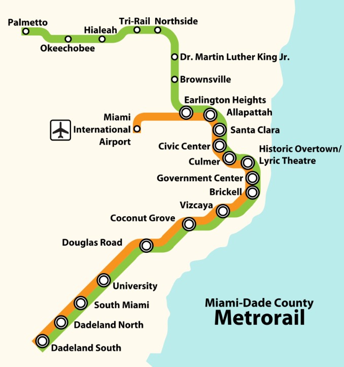
The Metrorail is a 25-mile elevated rail line with two routes: the Green Line and Orange Line. It connects areas like Kendall, Downtown Miami, Hialeah, and Miami International Airport. The Orange Line is especially useful for travelers heading to or from the airport, while the Green Line serves key residential and commercial areas.
Metromover
The Metromover is a free, automated people-mover system that operates in Downtown Miami and Brickell. It’s perfect for short trips to offices, hotels, museums, and the Bayside Marketplace. The Metromover has three loops—Inner Loop, Omni Loop, and Brickell Loop—offering frequent service every few minutes.
Fares and Passes
Metrorail fares are budget-friendly, with single rides, daily passes, and monthly EASY Cards available. Transfers to Metrobus are discounted or free with certain passes. The Metromover is always free to ride, making it a great option for exploring downtown.

