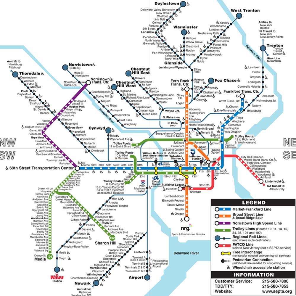
The Southeastern Pennsylvania Transportation Authority (SEPTA) operates Philadelphia’s subway system, providing a fast, affordable, and reliable way to navigate the city. Whether you’re a daily commuter, a student, or a visitor exploring historic landmarks, SEPTA’s subway lines make getting around Philadelphia simple and efficient.
Overview of SEPTA Subway Lines
Philadelphia’s subway network consists of two main lines:
- Market-Frankford Line (Blue Line) – Running east to west, this line connects 69th Street Transportation Center in Upper Darby to Frankford Transportation Center in Northeast Philadelphia. Key stops include 30th Street Station, 15th Street/City Hall, and Old City.
- Broad Street Line (Orange Line) – Running north to south, this line stretches from Fern Rock Transportation Center in North Philadelphia to NRG Station near the South Philadelphia Sports Complex. Popular stops include Temple University, City Hall, and Oregon Avenue.
Together, these lines provide direct connections to major neighborhoods, business districts, and tourist attractions.
SEPTA Subway Map & Stations
The SEPTA subway map is designed for easy navigation, with clearly marked stations and transfer points. The 15th Street/City Hall station serves as the main interchange, allowing passengers to transfer between the Blue and Orange lines. Both lines also connect to SEPTA’s Regional Rail, trolley routes, and bus services for seamless travel across the region.